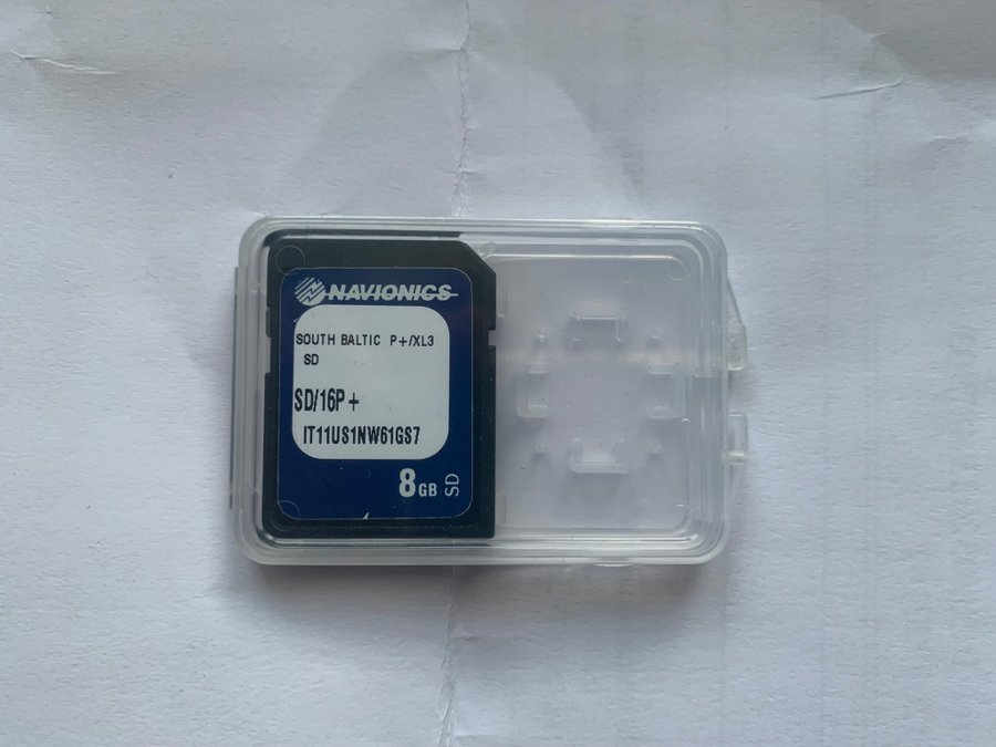
NAVIONICS 16P+ SOUTH BALTIC navigation charts Pol, Lit, Lat, Est, Gulf of Fin.
Slutar 19 nov 21:10
Utropspris
∙0 bud
722 kr
760 kr med köparskydd.
Fraktpriser till Sverige
122 kr Annat fraktsättSäljaren erbjuder ett alternativt fraktsätt. Vänligen se objektsbeskrivningen för mer info.
Samfrakt
1 dagAlla betalningar granskas av Tradera för din säkerhet.


Direktbetalning | Delbetalning | Faktura
Köparskyddet gäller alla betalsätt
1/0


Beskrivning
Översatt av
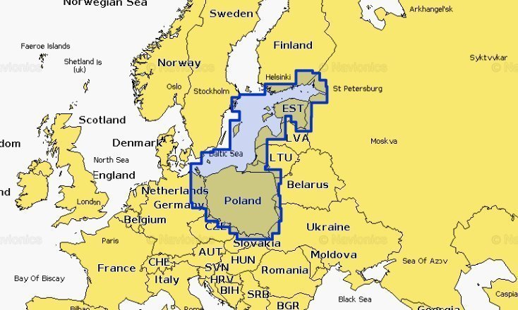
16P+ SOUTH BALTIC Poland, Russia, Lithuania, Latvia, Estonia, Gulf of Finland. From Rugen to Helsinki, Including Stockholm, Bornholm, Gotland, Hiiumaa and Saaremaa.
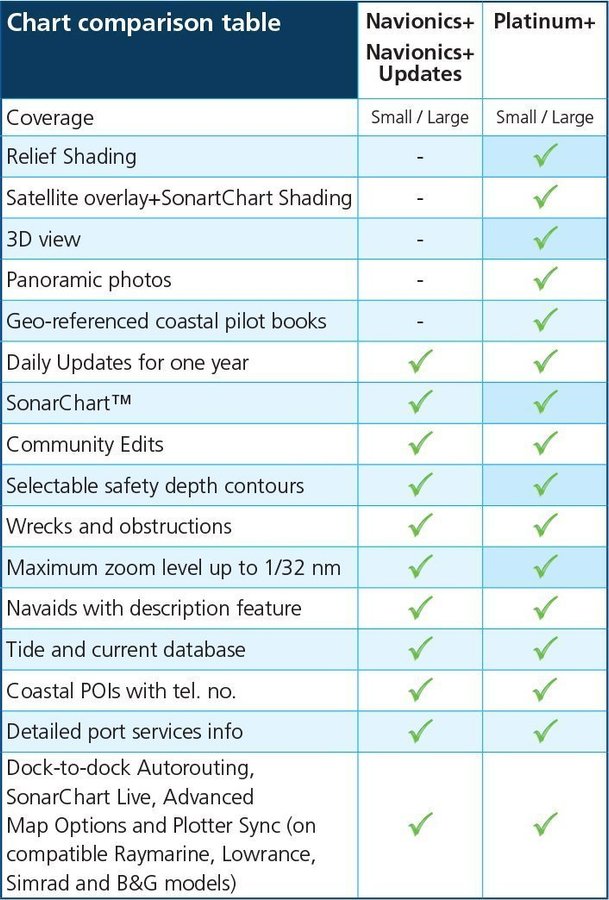
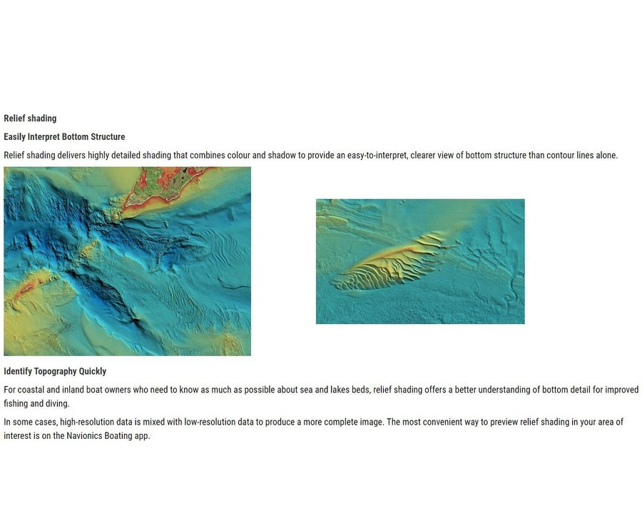
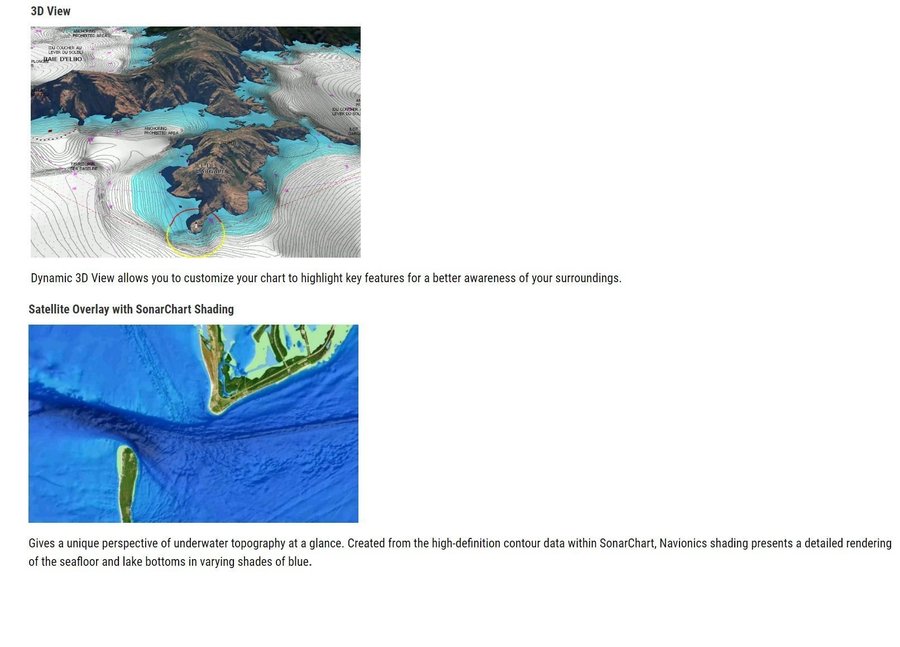
For those who want to know more, Platinum+ charts offer the same content and features of Navionics+, while adding the Relief Shading, 3D View, Panoramic Photos and the new satellite overlay with SonarChart Shading Layer. Platinum+ charts are available in both Small and Large coverage areas (the detail is the same in both).
Head out with confidence! All the same marine and lakes content and advanced features found in Navionics+ for GPS plotters are augmented with 3D View, satellite overlay and panoramic photos to provide the ultimate situational awareness. Designed with the most demanding boaters in mind.
Please check the photos. Please see my other items too, thnx.


