BP World-Wide Marine Distance Tables av Captain W. M. Hutchison, 1968, sjöfart
Slutar 2 aug 16:26
Utropspris
292 kr
309 kr med köparskydd.
Fraktpris inom Sverige
59 kr Instabox
59 kr PostNord Ombud
72 kr DHL
73 kr DSV
Samfrakt
14 dagarKan hämtas i
Alla betalningar granskas av Tradera för din säkerhet.








Direktbetalning | Delbetalning | Faktura
Köparskyddet gäller alla betalsätt
1/0
Beskrivning
Se även mina andra auktioner där jag säljer fler BP samlarsaker och andra äldre objekt, jag samfraktar gärna!
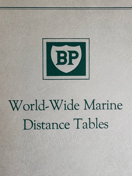
BP World-Wide Marine Distance Tables
Inbunden, 1968
grön med guld text på omslaget med skyddsomslag
två extra papper med korrigeringar efter boken var publicerad
Lite revor i skyddsomslaget, annars i mycket fint skick
storlek: ca 26 x 20.5 x 4 cm
vikt: ca 1410 gram
"Denna bok, "World-Wide Marine Distance Tables", sammanställd av Captain W. M. Hutchison och utgiven av BP Tanker Company Limited, tillhandahåller avstånd i nautiska mil mellan ett omfattande världsomspännande utbud av hamnar, inklusive terminaler för oljelastning och -lossning. Boken är uppdelad i sex tabeller som täcker olika geografiska områden, såsom Brittiska öarna, Nordsjön, Medelhavet, Röda havet, Indiska oceanen, Stilla havet och Nordatlanten. Den innehåller även kartor som visar de havsområden som täcks av de olika tabellerna. Boken trycktes om 1968 av W. & J. Jarvis Limited. Inkluderar korrigeringar 1 till 7 och korrigering nr 5."
"PROVIDING DISTANCES IN NAUTICAL MILES
BETWEEN A COMPREHENSIVE WORLD-WIDE
RANGE OF PORTS, INCLUDING OIL LOADING AND DISCHARGING TERMINALS
Compiled by
CAPTAIN W. M. HUTCHISON, C.B.E., F.R.G.S., F.R.S.A.
CHIEF MARINE SUPERINTENDENT,
BP TANKER COMPANY LTD
(THE SHIPPING ORGANISATION OF THE BRITISH PETROLEUM GROUP)
LONDON
Published by:
BP TANKER COMPANY, LTD.
LONDON.
Made and Printed in Great Britain by:
W. & J. JARVIS LIMITED
EAST GRINSTEAD
1958
Reprinted 1968
PREFACE
Tables to show at a glance the distance between any two ports in the world would result in an unwieldy book.
Therefore, this book has been arranged in the form of six tables, each complete in itself, covering the ports in a particular area and connected to adjoining areas by common points. When a distance between ports in different areas is required the appropriate connecting points between tables should be used, the total of the distances providing the required result. Connecting points are printed throughout in red.
The distances, in nautical miles, are usually for the shortest sea route or the route customarily followed by shipping. Where doubt might arise upon the route represented by any distance the route is denoted by a letter immediately above the distance, a key to these letters being given on the cover page of each table. Maps are provided to show the sea areas covered by the various tables and are not for navigational purposes.
ARRANGEMENT OF TABLES
TABLE I
Contains distances between ports in British Isles, English
Channel, Faroes, Iceland and Greenland.
TABLE 2
Contains distances between ports on coasts of the North Sea, Skagerrak, Kattegat, Baltic Sea, White Sea, Faroes, Iceland and Greenland.
TABLE 3
Contains distances between ports in Mediterranean Sea,
Black Sea and Seas adjacent thereto.
TABLE 4
Contains distances between
ports in Red Sea, Persian
Gulf. Indian Ocean, Bay of Bengal, South and East Africa, the West and North Coasts of Australia and parts of Indonesia.
TABLE 5
Contains distances between ports in parts of Indonesia, India, China, Japan, Australia, New Zealand and North and South Pacific Oceans.
TABLE 6
Contains distances between ports in North Atlantic Ocean including Greenland, Iceland and Norway from Aalesund to North Cape), South Atlantic Ocean and Gulf of Mexico."
BP World-Wide Marine Distance Tables
Inbunden, 1968
grön med guld text på omslaget med skyddsomslag
två extra papper med korrigeringar efter boken var publicerad
Lite revor i skyddsomslaget, annars i mycket fint skick
storlek: ca 26 x 20.5 x 4 cm
vikt: ca 1410 gram
"Denna bok, "World-Wide Marine Distance Tables", sammanställd av Captain W. M. Hutchison och utgiven av BP Tanker Company Limited, tillhandahåller avstånd i nautiska mil mellan ett omfattande världsomspännande utbud av hamnar, inklusive terminaler för oljelastning och -lossning. Boken är uppdelad i sex tabeller som täcker olika geografiska områden, såsom Brittiska öarna, Nordsjön, Medelhavet, Röda havet, Indiska oceanen, Stilla havet och Nordatlanten. Den innehåller även kartor som visar de havsområden som täcks av de olika tabellerna. Boken trycktes om 1968 av W. & J. Jarvis Limited. Inkluderar korrigeringar 1 till 7 och korrigering nr 5."
"PROVIDING DISTANCES IN NAUTICAL MILES
BETWEEN A COMPREHENSIVE WORLD-WIDE
RANGE OF PORTS, INCLUDING OIL LOADING AND DISCHARGING TERMINALS
Compiled by
CAPTAIN W. M. HUTCHISON, C.B.E., F.R.G.S., F.R.S.A.
CHIEF MARINE SUPERINTENDENT,
BP TANKER COMPANY LTD
(THE SHIPPING ORGANISATION OF THE BRITISH PETROLEUM GROUP)
LONDON
Published by:
BP TANKER COMPANY, LTD.
LONDON.
Made and Printed in Great Britain by:
W. & J. JARVIS LIMITED
EAST GRINSTEAD
1958
Reprinted 1968
PREFACE
Tables to show at a glance the distance between any two ports in the world would result in an unwieldy book.
Therefore, this book has been arranged in the form of six tables, each complete in itself, covering the ports in a particular area and connected to adjoining areas by common points. When a distance between ports in different areas is required the appropriate connecting points between tables should be used, the total of the distances providing the required result. Connecting points are printed throughout in red.
The distances, in nautical miles, are usually for the shortest sea route or the route customarily followed by shipping. Where doubt might arise upon the route represented by any distance the route is denoted by a letter immediately above the distance, a key to these letters being given on the cover page of each table. Maps are provided to show the sea areas covered by the various tables and are not for navigational purposes.
ARRANGEMENT OF TABLES
TABLE I
Contains distances between ports in British Isles, English
Channel, Faroes, Iceland and Greenland.
TABLE 2
Contains distances between ports on coasts of the North Sea, Skagerrak, Kattegat, Baltic Sea, White Sea, Faroes, Iceland and Greenland.
TABLE 3
Contains distances between ports in Mediterranean Sea,
Black Sea and Seas adjacent thereto.
TABLE 4
Contains distances between
ports in Red Sea, Persian
Gulf. Indian Ocean, Bay of Bengal, South and East Africa, the West and North Coasts of Australia and parts of Indonesia.
TABLE 5
Contains distances between ports in parts of Indonesia, India, China, Japan, Australia, New Zealand and North and South Pacific Oceans.
TABLE 6
Contains distances between ports in North Atlantic Ocean including Greenland, Iceland and Norway from Aalesund to North Cape), South Atlantic Ocean and Gulf of Mexico."
Köp mer och spara på frakten
Samfrakt
14 dagar Sluttid29 jul 22:30.Pris:93 kr,Ledande bud.
 Sluttid29 jul 22:31.Pris:52 kr,Eller Köp nu 62 kr,.
 Sluttid29 jul 22:32.Pris:99 kr,Eller Köp nu 114 kr,.
 Sluttid29 jul 22:32.Pris:116 kr,Eller Köp nu 129 kr,.
 Sluttid29 jul 22:33.Pris:98 kr,Eller Köp nu 112 kr,.
 Sluttid29 jul 22:33.Pris:129 kr,Eller Köp nu 139 kr,.
 Sluttid29 jul 22:34.Pris:249 kr,Ledande bud.
 Sluttid29 jul 22:46.Pris:79 kr,Eller Köp nu 116 kr,.
 Sluttid29 jul 22:47.Pris:129 kr,Eller Köp nu 139 kr,.
 Sluttid29 jul 23:48.Pris:66 kr,Eller Köp nu 78 kr,.
 Sluttid29 jul 23:48.Pris:54 kr,Eller Köp nu 68 kr,.
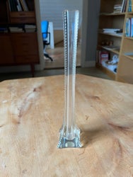 Sluttid29 jul 23:48.Pris:69 kr,Eller Köp nu 84 kr,.
 Sluttid29 jul 23:48.Pris:79 kr,Eller Köp nu 93 kr,.
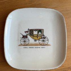 Sluttid29 jul 23:48.Pris:53 kr,Eller Köp nu 69 kr,.
 Sluttid29 jul 23:48.Pris:87 kr,Eller Köp nu 107 kr,.
 Sluttid29 jul 23:48.Pris:79 kr,Eller Köp nu 89 kr,.
 Sluttid29 jul 23:48.Pris:495 kr,Eller Köp nu 565 kr,.
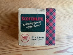 Sluttid29 jul 23:48.Pris:44 kr,Eller Köp nu 56 kr,.
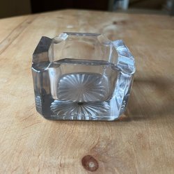 Sluttid29 jul 23:48.Pris:49 kr,Eller Köp nu 64 kr,.


Andra har även tittat påVisa alla
- Pris:.
- Pris:.
- Pris:.
- Pris:.